One of the really nice things about going to National Parks as opposed to other federal locations like National Forests is that the National Parks have educational programs that they put on pretty regularly. These are almost always worth going to (and well-worth the price of admission).
On the late afternoon of my last post I made sure to attend the “Petroglyph Walk” at Hovenweep.
Here’s the official notice of the Park Program:
Petroglyph Walk
Join us on a moderately strenuous 1 mile hike from the Vistor Center to view Little Ruin Canyon’s intriguing petroglyph panel.
You’ll notice that that is a pretty sparse weekly program. Hovenweep itself is a pretty small, but it does have a campground with a disproportionate 31 spaces. But I found (as at El Malpais) a lot of people would only camp there for a night. It’s as if they don’t really know about the surrounding Canyons of the Ancients.
I was the only person to show up for the Petroglyph Walk, which was led by one of their summer employees, Kasey, who came to the Park via The Student Conservation Association.
That is the picture Hovenweep posted on their Facebook page when Kasey’s summer stint was up.
There were other people around and Kasey and I tried to convince them to come along, but it ended up being just the two of us. Folks really ought to do these more—the official programs often will take you to places that are otherwise off-limits in the Parks.
The Petroglyph Panel is below the tip of Tower Point. Here’s our route (going from the trail at top to the bottom) superimposed onto a overhead Google satellite image.
[Click for the larger picture where the ruins show up better.]
As you can see, I’ve also added pointers to the Round Tower, Rim Rock House, and the Twin Towers.
Along the way, we had to pass through a slot where the sandstone had separated.
That’s the part of the trail that I’ve marked orange in the overhead view.
Just before we got to the petroglyph viewing area (marked in yellow on the overhead view), I took a picture toward Twin Towers.
It should be pretty easy for you to pick out the Round Tower, Rim Rock House, and the Twin Towers (with Park visitors checking out the latter).
When I had gone to Holly and Horseshoe and Hackberry earlier in the day, at the turn onto the dirt road there was a small sign with an arrow and this pictograph:
When we made it to the petroglyph panel, I discovered why.
You can see it right there in the middle of the picture.
By the way, in the satellite photo above I marked the petroglyph viewing area (it is of course protected by a fence) in yellow. Here’s a close-up via satellite that shows the area, and where the tower of Tower Point is located, on the rocks above.
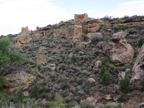
If you step back just a tad you can see that tower from down below.
After the Petroglyph Walk I went back to my campsite for dinner, and caught our Sleeping Ute friend covered in a bit of rainbow.
(I told you I’d force you to look at a lot of pictures of it.)
That picture was taken at 7:35pm.
The Star Program was a bit later that evening and I went to it, but as you might guess from the Sleeping Ute picture, there wasn’t a whole lot to see.
Next time I’ll write about doing some major bushwhacking (sagewhacking?) and a visit to the Painted Hand Pueblo.


I’m really enjoying reading these posts Bob. Sounds like a great trip so far!
I’m curious – Did Ranger Kasey have any comments on your barefooted-ness?
I should have included something about it in the entry, but posted before I remembered I wanted to do so.
Yes, she pretty much thought it was awesome. I’ve mentioned before that outdoor types (including rangers in all sorts of parks) are the most accepting people in that regard. They always “get it”.
I am also really enjoying reading about your trip. The photos are awesome, as usual! Thanks so much for all the time you put in keeping this blog alive. 🙂